I won the Boston Public Library's inaugural cartography challenge, No Choropleth, No Problem: Visualizing Immigration in Greater Boston. I was then contracted by the library's Leventhal Map and Education Center to make a series of five maps depicting Boston immigration patterns.
The maps are available in the library's digital collections and used in K-12 educational visits and programs. They are available under a Creative Commons BY-SA license.
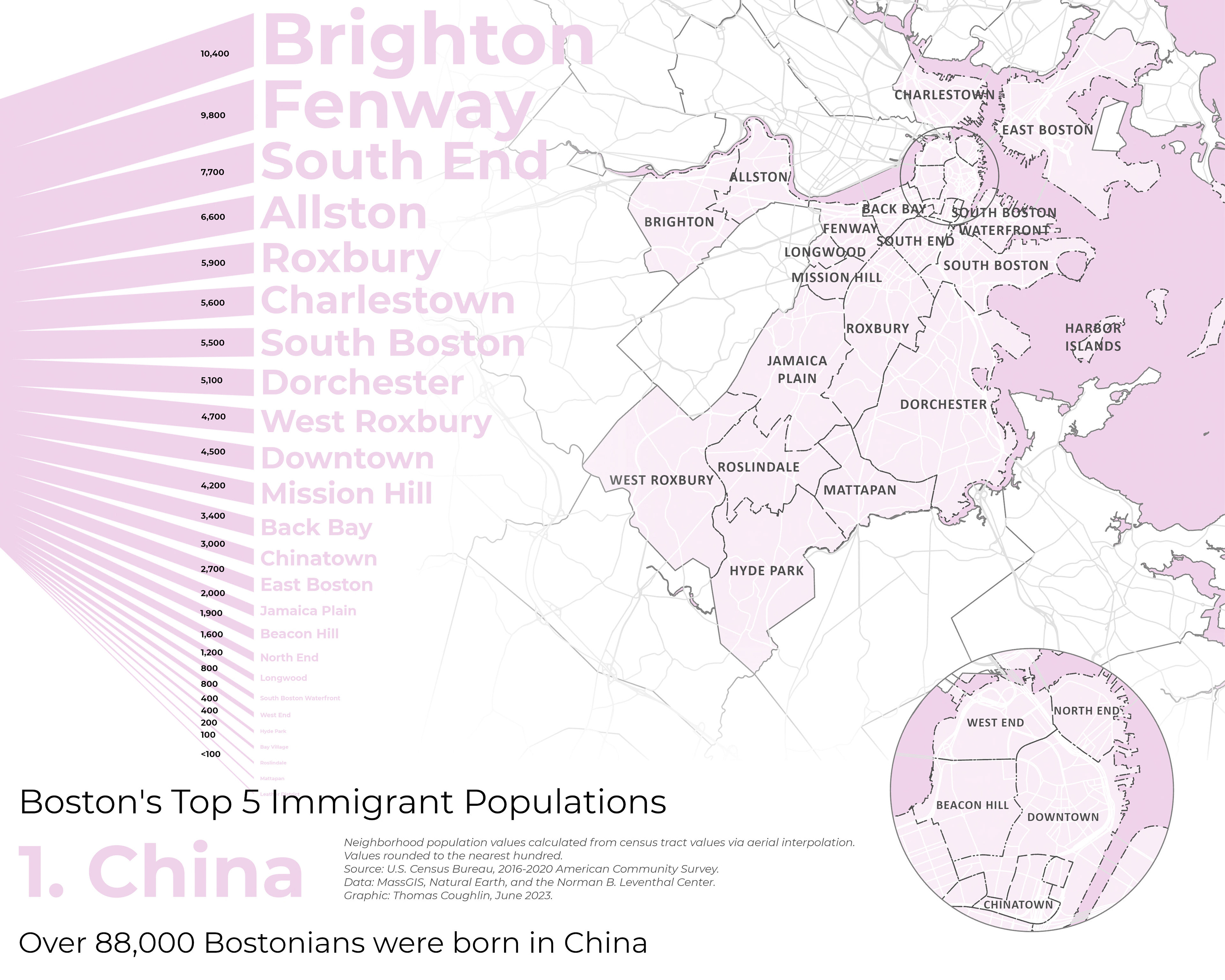
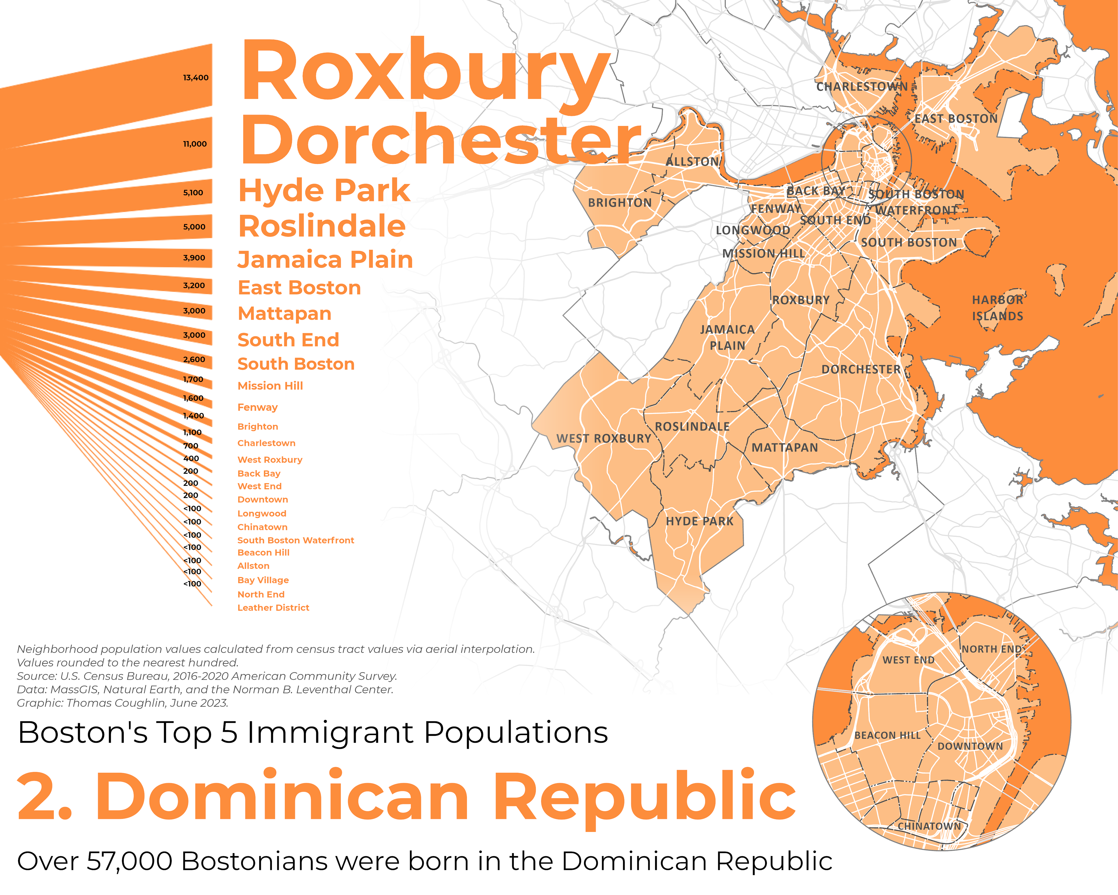
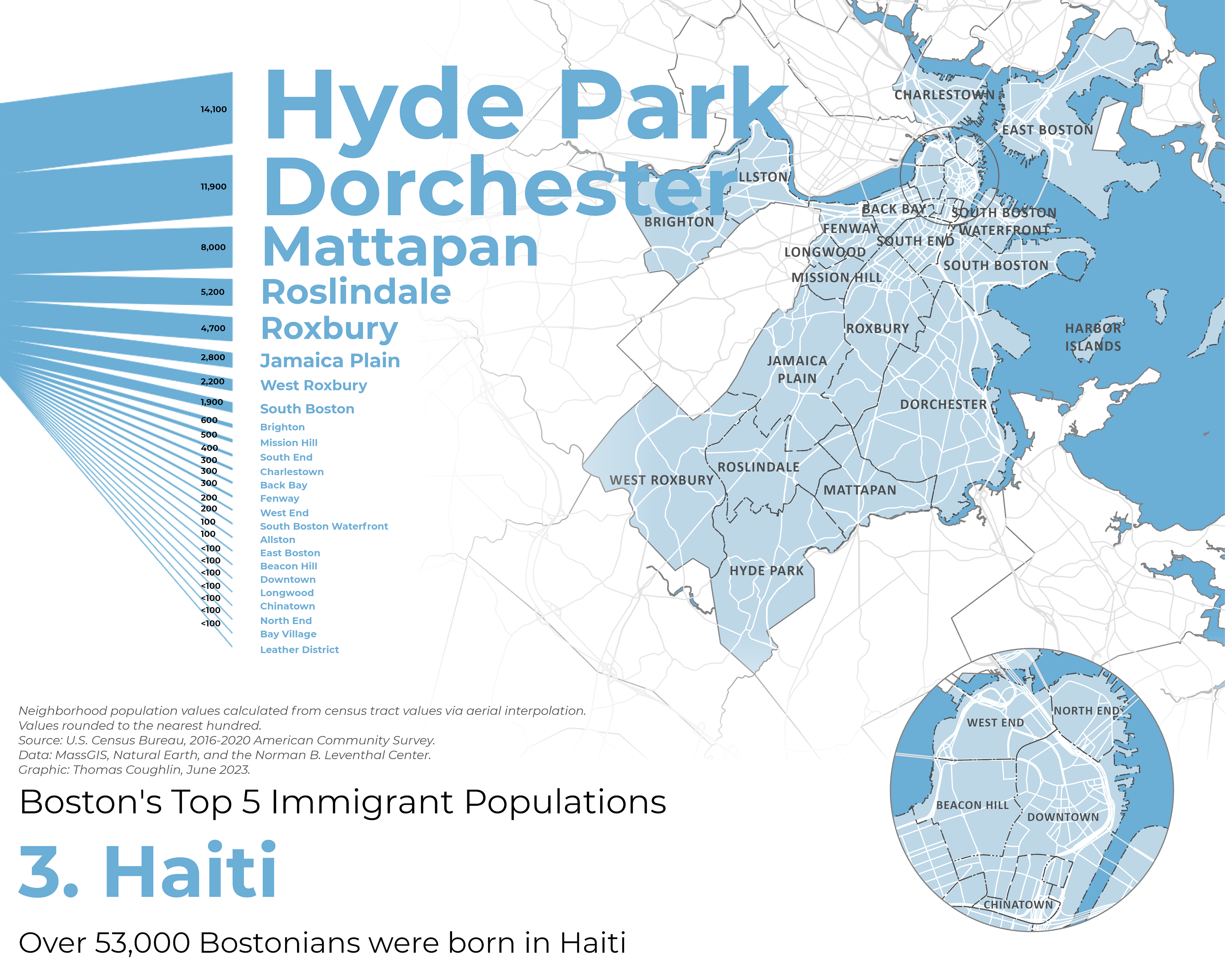
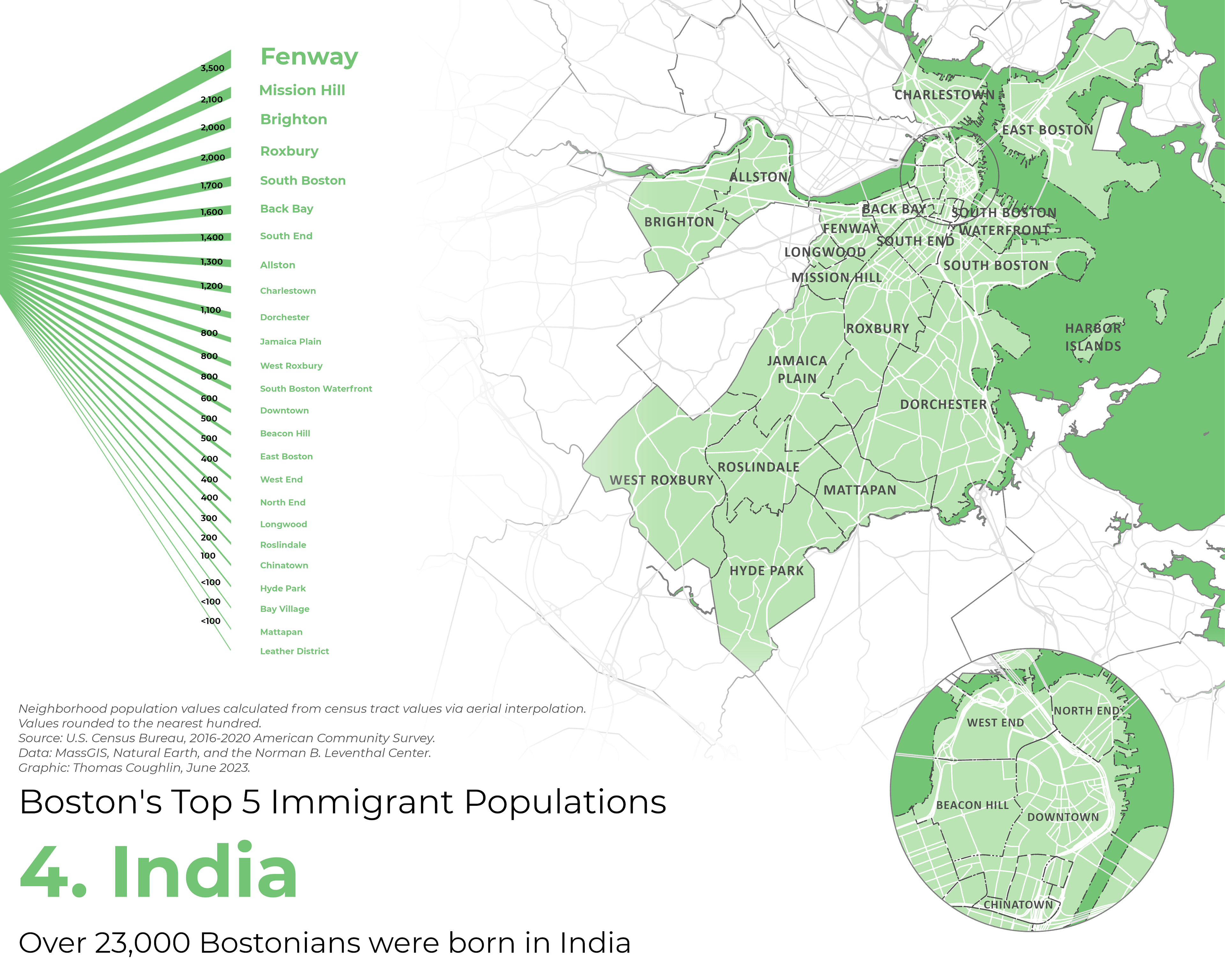
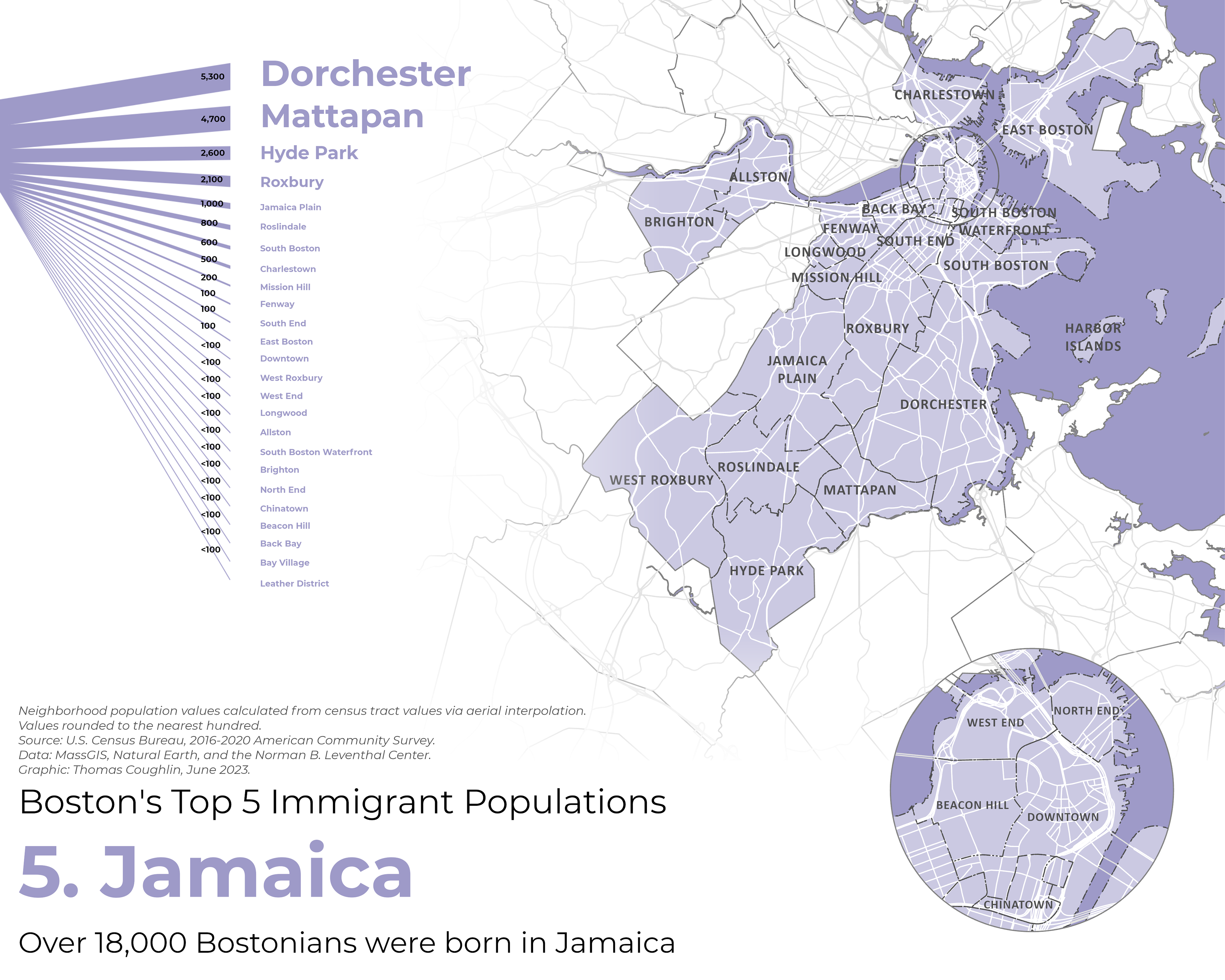
The hardest part about this project was wrangling the data. The library supplied me with American Community Survey data that told me where Boston area residents were born, but since that data was made by the US Census Bureau it was by census tract. I needed to re-map the data to a different set of polygons, Boston's neighborhoods. I had no idea how to do that, and after trying a few things I accomplished it by performing an aerial interpolation using ArcGIS Pro's geostatistical wizard. Luckily, through my job at Esri I both had access to that tool and could find out who wrote the documentation for it. I reached out to him and he kindly taught me how and why to run an aerial interpolation. My data set will be available in the Map Center's data portal.
Tools I used for this project included Microsoft Excel, ArcGIS Pro, and sankeymatic.com.